Google Turns Old Newspapers Into a Global Flood Warning System
Google just did something clever enough to make every hydrology department in the world feel a little inadequate. The company's research division unveiled Groundsource, a system that uses Gemini to extract structured flood data from 5 million archival news articles spanning decades and dozens of languages. That dataset, covering 2.6 million historical flood events across 150 countries, now trains an LSTM neural network that can predict urban flash floods up to 24 hours before they hit. The innovation is not in the model architecture. It is in recognizing that the world's largest sensor network for local disasters has been hiding in plain text all along.
This matters right now because flash floods are killing more people than almost any other weather event, and the death toll is accelerating. Over 200 people died in Valencia, Spain in October 2024. At least 135 died in the Texas Hill Country in July 2025, one of the deadliest inland floods in American history. Bangladesh lost 42 people and saw 5 million displaced in a single August 2024 event. The common thread across all of these is not that the rain was unprecedented. It is that warnings came too late or not at all. Google is betting that the solution to forecasting the unforecastable is not better physics simulations but better data archaeology.
From Patna to the Planet: Eight Years of Google Flood AI
Groundsource did not appear out of nowhere. Google's flood prediction work traces a clear arc from 2018, when researchers ran an initial pilot in Patna, India, feeding hydrological models into Google Public Alerts. That project expanded across India and Bangladesh, eventually covering 360 million people with riverine flood forecasts. In 2022, Google launched Flood Hub as a standalone platform and pushed into 20 countries, 15 of them in Africa. By 2023, coverage reached 60 new countries and 460 million people.
But all of that work addressed river flooding, the relatively predictable kind where you can measure water levels upstream and calculate when the crest will arrive downstream. Flash floods are a fundamentally different problem. They are caused by sudden, intense rainfall overwhelming drainage capacity in hours or even minutes. There is no upstream gauge to watch. Traditional forecasting requires dense networks of rain gauges, soil moisture sensors, and local radar, infrastructure that simply does not exist across most of the world.
The 2026 Groundsource announcement represents Google's answer to this infrastructure gap. Rather than waiting for developing nations to build out sensor networks that took wealthy countries decades to establish, the team asked a different question: what if the historical record already exists, just not in a format machines can read?
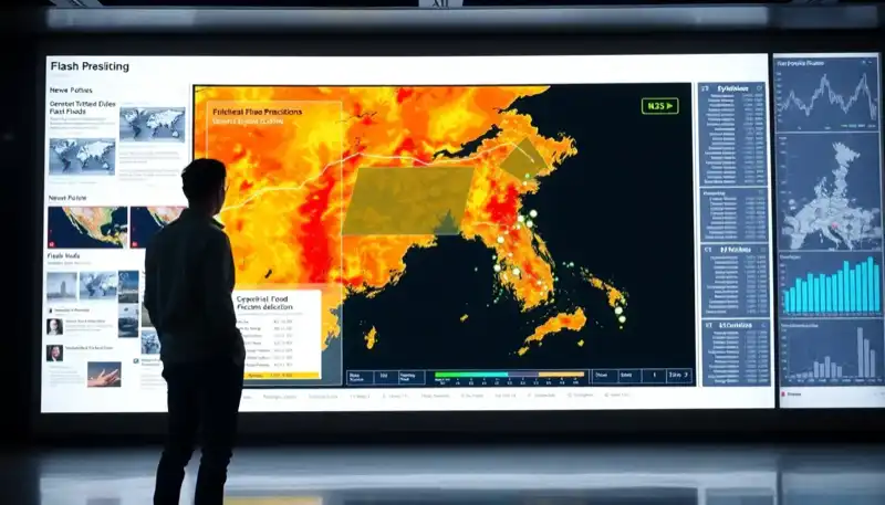
The Architecture: Gemini as Data Refinery, LSTM as Forecaster
The technical pipeline has two distinct stages, and understanding each is important because they solve very different problems.
Stage one is data extraction. Gemini processes millions of news articles in dozens of languages, identifying reports that describe flash flood events. But identification alone is not enough. The model must confirm specific locations (geotagging to a usable resolution), extract timing information, and distinguish between firsthand reporting of an actual event versus speculation, historical references, or metaphorical usage. Google describes this as extracting "ground truth from unstructured data with high precision." The output is a geo-tagged time series of historical flash flood occurrences spanning decades, essentially a synthetic sensor network reconstructed from journalism.
Stage two is prediction. The forecasting model uses a recurrent neural network built on Long Short-Term Memory units, an architecture specifically suited for time-series data. The LSTM ingests global weather forecasts from four sources: NASA IMERG for historical precipitation patterns, NOAA CPC for global precipitation data, ECMWF's Integrated Forecast System for high-resolution atmospheric modeling, and Google DeepMind's own AI-based medium-range weather forecasting model. Crucially, the model also incorporates static attributes like urbanization density, topography, and soil absorption rates. These contextual features help the model understand why certain areas flood under conditions that would be harmless elsewhere.
The system operates at 20-by-20-kilometer grid resolution over 24-hour prediction windows, targeting areas with population density above 100 people per square kilometer. That resolution is coarse by the standards of the U.S. National Weather Service, which uses local radar to track precipitation cells in near real-time. But Google is not trying to replace the NWS. It is trying to provide something where nothing existed before.
The Data Arbitrage: Why News Reports Are Better Than You Think
The most provocative aspect of Groundsource is its implicit argument that unstructured text can substitute for physical instrumentation. This deserves scrutiny because it challenges decades of conventional thinking in earth sciences.
Traditional flood modeling depends on what hydrologists call "ground truth," verified observations of what actually happened on the ground. Without ground truth, supervised machine learning models cannot learn the statistical relationships between weather conditions and flood outcomes. This is why flash flood forecasting has lagged so far behind river flood forecasting: flash floods are too short-lived, too localized, and too chaotic to be comprehensively measured by existing sensor networks.
News reports, however, capture something sensors miss entirely: human impact. A rain gauge can tell you that 80 millimeters fell in three hours. It cannot tell you that the resulting runoff submerged a market district to waist height. News reports encode the relationship between meteorological inputs and real-world consequences in a way that raw sensor data never does. They also have a natural bias toward events that actually affected people, which is precisely the signal a warning system needs to optimize for.
The weakness is equally clear. News coverage is not uniformly distributed. It clusters around urban areas, around events dramatic enough to attract reporters, and around regions with functioning press infrastructure. A flash flood that wipes out a rural village in a country with limited press freedom may never generate a single article. Google acknowledges this by limiting the model to areas above 100 people per square kilometer. But even with that constraint, Groundsource covers vastly more territory than any physical sensor network could in the near term.
There is a deeper insight here about the economics of data. Building and maintaining a weather radar station costs millions of dollars and requires continuous expert staffing. News articles are free, already exist, and are being generated continuously. Google essentially found a way to convert a century of journalism into a training dataset at the cost of Gemini inference time. The marginal cost of adding another country to the system is nearly zero, assuming local news archives are digitally accessible.
The Competitive Landscape: Who Else Is Playing This Game
Google is not the only organization applying AI to weather and disaster prediction, but the competitive dynamics reveal how differently each player approaches the problem.
NOAA has been integrating AI into its forecasting stack, most notably by taking Google DeepMind's GraphCast model and fine-tuning it on NOAA's own Global Data Assimilation System. This is a cooperative-competitive dynamic that benefits both parties: NOAA gets a better model, and Google gets validation from the world's most authoritative weather agency. But NOAA's mandate is the United States. It has no charter to provide flash flood warnings in Lagos or Dhaka.
The European Centre for Medium-Range Weather Forecasts (ECMWF) operates its Integrated Forecast System globally and has been cautiously integrating machine learning components. ECMWF provides some of the weather inputs that Groundsource consumes, making it more of a supplier than a competitor. IBM's Weather Company, now part of the broader IBM AI ecosystem, focuses primarily on commercial applications: enterprise weather intelligence for logistics, agriculture, and insurance. It targets paying customers, not humanitarian needs.
The real competition is between two philosophies. The established meteorological agencies invest in better physics simulations augmented by AI. Google invests in finding clever data sources that make expensive simulations unnecessary. Both approaches have merit. Physics models generalize better to truly unprecedented events. Data-driven models are cheaper to deploy and can reach populations that physics models currently ignore. The most likely outcome in the next five years is convergence: hybrid systems that use physics to constrain AI models while using AI to fill gaps in observational data.
What no one else is doing, as far as public research indicates, is mining unstructured text at scale to create synthetic ground truth datasets. If Groundsource proves reliable over the next few flood seasons, this methodology will be copied aggressively. The approach generalizes to any disaster type where news coverage exists but sensor coverage does not: landslides, heat waves, wildfire impacts, industrial accidents.
The Global South Warning Gap Is a Policy Failure, Not a Technology Problem
Google's research blog frames Groundsource as a technology breakthrough, and it is. But it also inadvertently highlights a decades-long policy failure. The reason flash flood warnings do not exist in most of Africa, South Asia, and Latin America is not that the science is impossible. It is that the international community has consistently underfunded weather infrastructure in developing nations.
The World Meteorological Organization has documented this gap repeatedly. Less than half of developing countries have access to multi-hazard early warning systems. There is an inverse correlation between national GDP and the availability of public weather data. Countries with the highest flood mortality have the least warning infrastructure. This is not a coincidence. It is the predictable result of decades of underinvestment.
Google stepping in with a free, globally available tool is genuinely useful. The Flood Hub platform now shares data with emergency response agencies worldwide, and the flash flood forecasts cover 150 countries. But there is an uncomfortable dependency forming here. When a private company provides critical public safety infrastructure that governments cannot or will not fund, the public becomes dependent on that company's continued interest. Google has shut down products before. It has reorganized research priorities. The long-term resilience of this system depends on whether the underlying methodology gets adopted by public institutions or remains a Google property.
The research paper and dataset are public, which is encouraging. But operationalizing a research prototype into a reliable, continuously maintained warning system requires sustained investment that goes far beyond publishing a paper. The question is whether organizations like the WMO, national weather services, and international development agencies will build on Groundsource or simply rely on Google to keep running it.
What Comes Next: Three Predictions
First, the Groundsource methodology will expand beyond floods within 18 months. Google's own blog post hints at applications to landslides and heat waves. The technique of using LLMs to extract structured disaster data from unstructured text is general-purpose. Expect to see synthetic ground truth datasets for wildfires, droughts, and possibly even disease outbreaks by 2028.
Second, insurance companies will become the biggest commercial consumers of this data. The reinsurance industry has been desperate for better flood risk models in emerging markets. Munich Re, Swiss Re, and others currently price flood risk in developing countries using crude approximations. A validated, global-scale flash flood risk dataset changes the economics of insuring properties and infrastructure across the Global South. This is where Google's investment pays for itself, not through Flood Hub directly, but through the commercial value of the underlying data.
Third, the 20-kilometer resolution will improve to below 5 kilometers within two years. The current resolution limit is a function of the training data, not the model architecture. As Google refines Groundsource to extract more precise location data from news reports, and as the system potentially incorporates social media posts, municipal emergency records, and satellite imagery, the spatial precision will tighten significantly. When it does, Groundsource stops being a supplement to national weather services and starts being a replacement for countries that lack them entirely.
The flash flood problem is getting worse. Climate change is loading the atmosphere with more moisture, making extreme precipitation events more frequent and more intense. Urbanization is paving over natural drainage, concentrating runoff into channels that were not designed for current rainfall volumes. The combination is lethal. Google's insight, that the historical record of this lethality is already written down in millions of news articles, is the kind of lateral thinking that makes you wonder why nobody tried it sooner. The answer, of course, is that nobody had a model capable of reading 5 million articles in 50 languages until now.